Are Terrestrial Globes Accurate?
Terrestrial globes have long been used as a tool for understanding and visualizing the Earth’s geography. These globes are meant to represent the planet’s features with accuracy and detail, allowing users to better grasp its size, shape, and topography. However, just how accurate are these globes? In this article, we will explore the limitations and potential inaccuracies of terrestrial globes.
Understanding Globe Construction
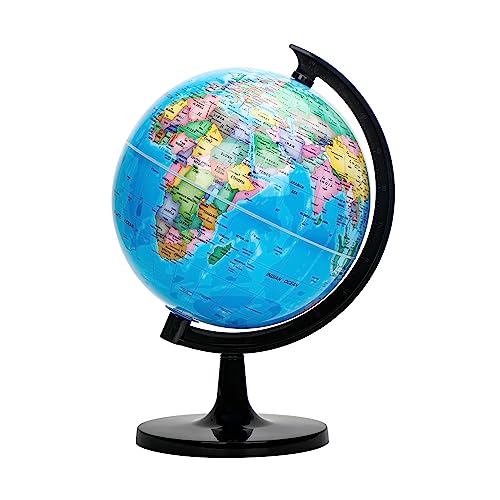
Globes are spherical representations of the Earth. They are made using a variety of materials such as paper, plastic, or metal, and feature a detailed map of the Earth’s surface. The construction process involves transferring the Earth’s geographic data onto the curved surface of the globe. This process requires cartographers to stretch and distort the map to fit the spherical shape, leading to potential inaccuracies. It is important to note that globes cannot perfectly represent the Earth due to its complex and irregular shape.
Limitations of Scale and Detail
One of the main limitations of terrestrial globes is the difficulty of accurately representing the Earth’s scale and detail. The Earth is a large and diverse planet, with varying landforms, bodies of water, and other features. When mapping these features onto a globe, certain compromises have to be made to fit everything onto a finite-sized sphere. As a result, smaller and more detailed features, such as rivers, lakes, and mountains, may not be accurately represented or may be omitted entirely. Additionally, the scale of the globe may not accurately reflect the true size of certain regions, leading to distortions.
Map Projection Distortions
A map projection is the method used to portray the Earth’s curved surface onto a flat map or globe. There are various map projections, each with its own strengths and weaknesses. No single map projection can accurately represent all aspects of the Earth’s geography. The process of projecting a map onto a globe can introduce distortions in terms of shape, scale, and direction. These distortions become more significant as the size of the projection increases. Different regions of the world may be distorted in different ways, depending on the map projection used. This can lead to inaccuracies in terms of representing the true size and shape of countries and continents.
Updates and Changes over Time
Another aspect that affects the accuracy of terrestrial globes is the constant evolution and change of the Earth’s geography. The Earth’s surface is dynamic, with natural processes such as erosion, tectonic activity, and climate change constantly shaping and altering its features. This means that the data used to create terrestrial globes may become outdated over time. New discoveries, such as the identification of previously unknown land formations or changes in the course of rivers, may not be reflected on older globes. To ensure accuracy, globes need to be regularly updated with the latest geographic information.
Terrestrial globes are valuable tools for visualizing and understanding the Earth’s geography. They provide a three-dimensional representation that can help individuals grasp the planet’s size, shape, and topography. However, it is important to acknowledge that globes have limitations and potential inaccuracies. The distortions caused by map projections, the compromises made in representing scale and detail, and the need for regular updates all contribute to the potential inaccuracies of terrestrial globes. Despite these limitations, globes remain a valuable resource for educational purposes and are widely used in schools, museums, and other institutions around the world.


